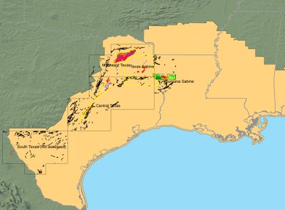
AAPG Datapages and the GIS Publications Committee wish to thank Peter Warwick and the USGS for allowing the GIS project of the Geologic Assessment of Coal in the Gulf of Mexico Coastal Plain, U.S.A. to be posted on Datapages' GIS Open Files page, thereby making it available to the public as a free download.
Geologic Assessment of Coal in the Gulf of Mexico Coastal Plain, USA
(GIS files to accompany AAPG Discovery Series No. 14)
By Peter Warwick, et al., U.S. Geological Survey
 The Geologic Assessment of Coal in the Gulf of Mexico Coastal Plain, USA, is the fifth in a series of reports by the U.S. Geological Survey on the assessment of the quantity and quality of the nation’s coal deposits that potentially can be mined during the next few decades. For eight years (1995-2003), geologic, geochemical, and resource information was collected and compiled for the five major coal-producing regions of the United States: the Appalachian Basin, Illinois Basin, Northern Rocky Mountains and Great Plains, Colorado Plateau, and the western part of the Gulf of Mexico Coastal Plain (Gulf Coast) region. The results of these other USGS coal assessments may be found at: http://energy.cr.usgs.gov/coal/coal_assessments/index.html.
This volume contains the assessment results for the Gulf of Mexico Coastal Plain region. The contents of this volume were compiled mainly during the eight-year period mentioned above. However, every effort has been made to update the references and text to incorporate new work that has been completed since the original compilation period.
This entire volume is available as a CD-ROM through the AAPG Bookstore. However the GIS files that accompany this project (and which are included on the CD-ROM) also are available free to the public as a download (GIS files require ArcGIS software). The GIS aspect of this project has been peer-reviewed by the AAPG GIS Publications Committee.
Click here to download the GIS project.
The recording of Peter Warwick's Webinar is now available!